AECA Solutions
Geospatial Intelligence | UAV Solutions | Digital Transformation
Our website is currently under development, but our drones are still flying and our data's still crunching.
Geospatial Intelligence | UAV Solutions | Digital Transformation
Our website is currently under development, but our drones are still flying and our data's still crunching.
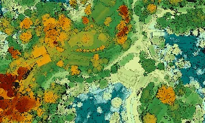
Advanced GIS and remote sensing services for informed decision-making in land, city, and resource management.
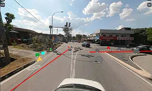
High-resolution road data using LiDAR and panoramic systems for road asset management and condition monitoring.
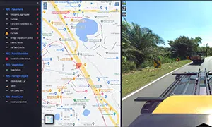
AI-powered defect detection and asset tagging for infrastructure maintenance and digital inventory creation.
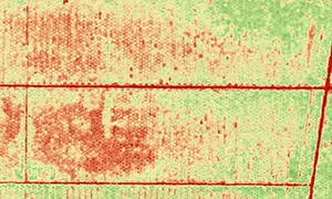
NDVI and multispectral mapping using drones and sensors for health and yield insights.

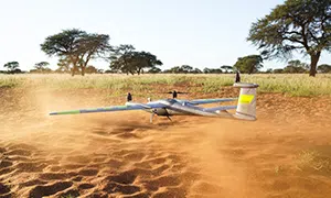
Real-time aerial surveillance using long-range UAVs like Quantum Systems Vector and DJI Enterprise drones.

Wildfire and environmental threat detection using satellite tech (Ororatech) and drone-mounted sensors.
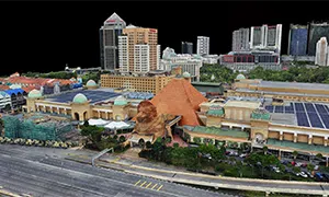
3D digital twin platforms powered by drone and IoT for urban planning and smart cities.
Official partner and reseller for Quantum Systems, Ororatech, 3DT Scanfly, DJI, Sentera, Micasense and Sony